Dedicated locality research platform
Dedicated locality research platform
Enter your email address and you will receive
a link to reset your password
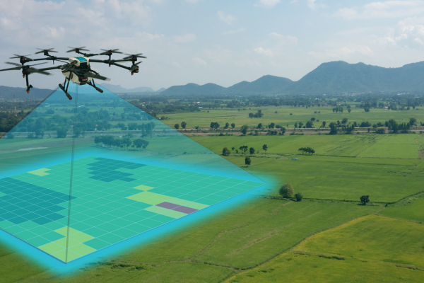
The state government of Maharashtra has achieved a significant milestone by completing 97% of the mapping of rural residential land parcels through the utilization of drone technology. According to officials from the state settlement commissioner's office, this innovative approach has revolutionized the process of delineating boundaries for villages, government properties, and semi-government properties, as well as facilitating the issuance of property cards.
Out of a total of 31,984 villages within the state, drone surveys have been successfully conducted in 31,069 villages, as reported by the settlement commissioner's office. To support this initiative, the Central government has provided the state with 25 drones specifically designated for this purpose. The primary objectives of this drone-based mapping initiative are to resolve property title disputes and discrepancies, ultimately leading to the issuance of property cards once thorough verification is carried out.
Among the villages that have undergone drone mapping, in-depth on-site assessments with landholders have been finalized in 17,330 villages. An official elaborated on the previous methodology, noting that mapping procedures were traditionally performed manually, underscoring the transformative impact of drone technology in expediting the entire undertaking.
The inception of this project took place in 2018 at Sonori village in the Purandar tehsil of Pune district, commencing as a pilot initiative under the Svamitva scheme. This scheme was conceptualized to provide comprehensive property validation solutions for rural regions. Although the project encountered delays over a two-year period due to the global Covid-19 pandemic, it has regained momentum in recent years. Currently, the pending mapping of drones remains limited to only 915 villages, with plans to address this shortly, as affirmed by an official closely associated with the initiative.
In terms of tangible outcomes, the exercise has yielded impressive results, including the generation of 12,496 maps and 8,846 property cards. This accomplishment translates to approximately 40% of the targeted maps and 28% of the intended property cards. By implementing this scheme, the overarching goal is to ensure that every rural household possesses an accurate record of property rights. This feat is made possible through the utilization of drones and the continuous operating reference station technology, a process that facilitates the capture of property images with utmost precision, as articulated by a central government representative.
In conclusion, the deployment of drone technology for mapping rural residential land parcels stands as a monumental achievement for the state government. Through the proactive efforts of the state settlement commissioner's office and collaboration with the Central government, the initiative has not only overcome challenges like the Covid-19 pandemic but has also streamlined the process of defining property boundaries and issuing property cards. As the project nears its completion with only a handful of villages left to be mapped, the positive impact on rural households' property rights and overall land management is undeniable.
Propscience is India’s dedicated property news portal. We cover the latest events, news, trends, deals, new launches and more.
All our services and tools are completely free of cost and available 24X7!