Location & Projects
 Building & Flat
 Back
BackProject Address
| City | Mumbai City |
| Zone | Western Suburbs |
| Locality | Andheri (west) |
| Sub-Locality | Oshiwara |
| Pin Code | 400053 |
| Post Office | NA |
| Police Station | NA |
Administrative Coordinates
| State/UT | Maharashtra |
| District | Mumbai Suburban |
| Division | Konkan |
| Taluka | Andheri |
| Village | Andheri |
| Street | Relief Road |
| Pin Code | 400102 |
| Locality Area | 0, 2554.5 |
Boundaries
| Boundaries - East Rehab Buildings 4 And 5 |
Boundaries - West Raghavendra Mandir Road |
Boundaries - North Sale Building No 1 |
Boundaries - South Rehab Building No 2 |
| Survey No / CTS No / Plot Bearing No / Final Plot No. 406 Pt, 407 Pt, 410/c 1 Pt, 1c/3 Pt |
Map Address
Oshiwara, Andheri West, Mumbai, Maharashtra 400102

Brochure Address
NA

Municipal Corporation / Council & Ward
Municipal Corporation Of Greater Mumbai
NA

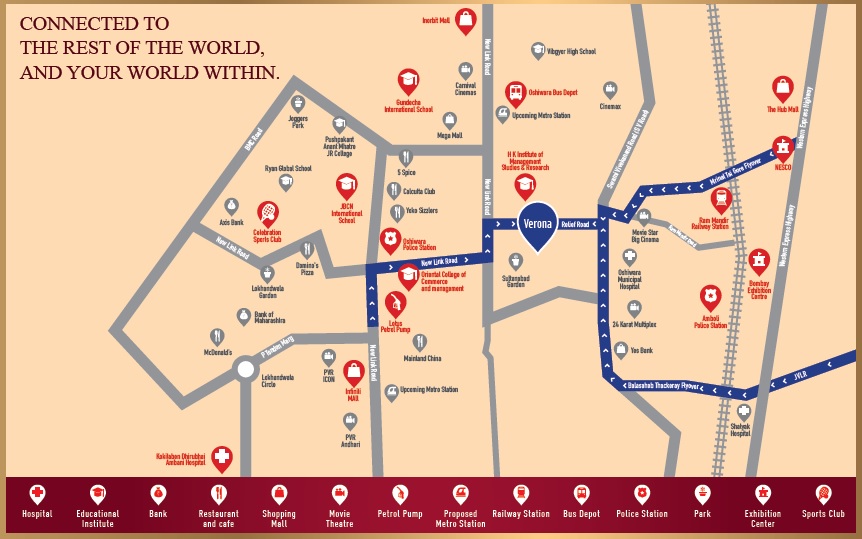
Physical Infrastructure
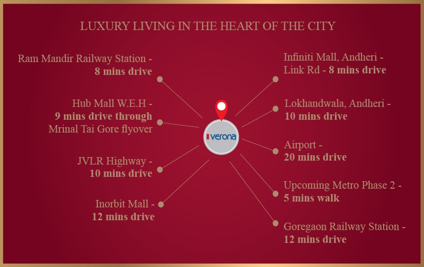
Railway Station
Ram Mandir Railway Station
2 km
Metro Station
D N Nagar Metro Station
4 km
Metro Station
Azad Nagar Metro Station
4 km
Educational Institutes
Sunflower Secondary School
1 km
Medical Care
Kokilaben Dhirubhai Ambani Hospital
4 km
View More
View Less
Social Infrastructure
Commercial Infrastructure
Business Districts
| BKC | -- |
| Nariman Point / Fort | -- |
| Andheri East | -- |
| Thane | -- |
| Lower Parel | -- |
 Locality
 Neighbourhood
|
|
-
|
|
|
-
|
|
|
-
|
|
|
-
|
|
|
-
|
Contact Details
| Organisation Name ( Builder's Name) | NA | Organisation Type | NA |
| Website URL | NA | Office Number | NA |
| Description Of Other Type Of Organisation | NA | ||
Address Details
| Block Number | NA | Building Name | NA |
| Street Name | NA | Locality | NA |
| Landmark | NA | Division | NA |
| Pin Code | NA | Taluka | NA |
| State /UT | NA | District | NA |
| Village | NA |
| Consultant Type | As per Brochure | As per RERA |
|---|