Location & Projects
 Building & Flat
 Back
BackProject Address
| City | Thane |
| Zone | Thane West |
| Locality | Owle Manpada Kolshet |
| Sub-Locality | Brahmand |
| Pin Code | 400607 |
| Post Office | NA |
| Police Station | NA |
Administrative Coordinates
| State/UT | Maharashtra |
| District | Thane |
| Division | Konkan |
| Taluka | Thane |
| Village | Thane (m Corp.) |
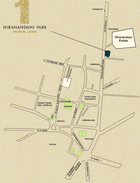
| Street | Ghodbunder Road |
| Pin Code | 400607 |
| Locality Area | One Hiranandani Park, 605.51 |
Boundaries
| Boundaries - East Park |
Boundaries - West 60 M D P Road |
Boundaries - North 99b Pt |
Boundaries - South S No 275 |
| Survey No / CTS No / Plot Bearing No / Final Plot No. 99/2 Pt |
Map Address
One Hiranandani Park, GB . Road. Thane (W)

Brochure Address
One Hiranandani Park, Gb . Road. Thane (w)

Municipal Corporation / Council & Ward
Thane Municipal Corporation
NA

Physical Infrastructure
Railway Station
Thane Railway Station
7.2 km
Medical Care
Jupiter Hospital
4.7 km
Medical Care
Titan Hospital
1.1 km
Educational Institutes
Orchids The International School
1.7 km
Educational Institutes
Sulochanadevi Singhania School
6.5 km
International Airport
Chhatrapati Shivaji Maharaj International Airport
26.0 km
Metro Station
Brahmand Metro Station
1.7 km
View More
View Less
Social Infrastructure
Commercial Infrastructure
Business Districts
| BKC | 28.4 km |
| Nariman Point / Fort | 43.8 km |
| Andheri East | 26.6 km |
| Thane | 3.1 km |
| Lower Parel | 36.0 km |
| Wagle Industrial Estate | 9.1 km |
 Locality & Neighbourhood
|
|
-
|
|
|
-
|
|
|
-
|
|
|
-
|
|
|
-
|
Contact Details
| Organisation Name ( Builder's Name) | NA | Organisation Type | NA |
| Website URL | NA | Office Number | NA |
| Description Of Other Type Of Organisation | NA | ||
Address Details
| Block Number | NA | Building Name | NA |
| Street Name | NA | Locality | NA |
| Landmark | NA | Division | NA |
| Pin Code | NA | Taluka | NA |
| State /UT | NA | District | NA |
| Village | NA |
| Consultant Type | As per Brochure | As per RERA |
|---|