Location & Projects
 Building & Flat
 Back
BackProject Address
| City | Mumbai City |
| Zone | Eastern Suburbs |
| Locality | Chembur (east) |
| Sub-Locality | NA |
| Pin Code | 400071 |
| Post Office | Chembur |
| Police Station | NA |
Administrative Coordinates
| State/UT | Maharashtra |
| District | Mumbai Suburban |
| Division | Konkan |
| Taluka | Kurla |
| Village | NA |
| Street | Waman Tukaram Patil Marg |
| Pin Code | 400071 |
| Locality Area | Chembur, 1817 |
Boundaries
| Boundaries - East Gaothan Road |
Boundaries - West Cts No 619-24 And 619-21 |
Boundaries - North Sub-division Road |
Boundaries - South Cts No 619-28 |
| Survey No / CTS No / Plot Bearing No / Final Plot No. Plot No.16 And 17, Cts No.619/25 |
Map Address
Plot No. 16/17, Motibaug, Off, Waman Tukaram Patil Marg, opp. Dukes Factory, Chembur, Mumbai, Maharashtra 400071

Brochure Address
Plot No. 16/17, Motibaug, Near Shivaji Maharaj Chowk, Waman Tukraram Patil Marg, Chembur, Mumbai - 400071

Municipal Corporation / Council & Ward
Municipal Corporation Of Greater Mumbai
Ward M East

Physical Infrastructure
Medical Care
Zen Multi Speciality Hospital
2.2 km
Educational Institutes
St. Anthony's Girls' High School, St Anthony's Rd, Chembur, Mumbai, Maharashtra 400071
2 km
Retail & Supermarkets
Society Stores, Opp. Apna Sahakari Bank & Sbi Near Joy Hospital, Dk Sandu Marg, Near Sandhu Garden, Chembur (e, Mumbai, Maharashtra 400071
1.8 km
International Airport
Chhatrapati Shivaji Maharaj International Airport
13 km
Bus Station
Duks Colony, Mbpt Colony, Best Colony, Chembur, Mumbai, Maharashtra 400088
400 m
Railway Station
Chembur Railway Station
2.3 km
Highways & Roadways
Freeway
2 km
Medical Care
Inlaks General Hospital, Chembur Colony, Indira Nagar, Chembur, Mumbai, Maharashtra 400074
1.9 km
Educational Institutes
Swami Vivekanand High School And Junior College, Rd Number 2, Sindhi Society, Chembur, Mumbai, Maharashtra 400071
3.3 km
Domestic Airport
Domestic Airport Terminal 1-b, Navpada, Vile Parle East, Vile Parle, Mumbai, Maharashtra 400099
13.4 km
Monorail Station
V.n.p. (r.c. Marg), Charai, Chembur, Mumbai, Maharashtra 400071
2.1 km
View More
View Less
Social Infrastructure
Malls & Entertainment
K Star Mall, Sion - Trombay Rd, Near Chembur, Diamond Garden, Basant Garden, Chembur, Mumbai, Maharashtra 400071
1.2 km
Commercial Infrastructure
Business Districts
| BKC | 7.5 km |
| Nariman Point / Fort | 18.6 km |
| Andheri East | 13 km |
| Thane | 22.8 km |
| Lower Parel | 13 km |
| Vashi, Navi Mumbai, Maharashtra | 11 km |
 Locality & Neighbourhood
 Locality & Neighbourhood
 Locality & Neighbourhood
|
|
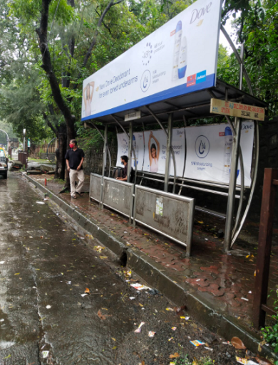
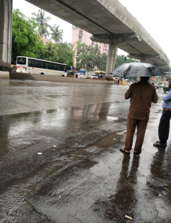
Prone to traffic jams during rush hour
|
|
|
76
|
|
|
51 to 85 dB
|
|
|
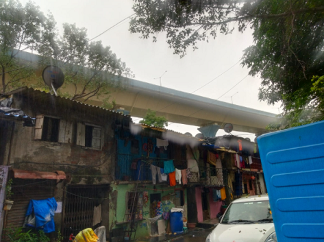
There are slums settlements near the project
|
|
|
-
|
Contact Details
| Organisation Name ( Builder's Name) | NA | Organisation Type | NA |
| Website URL | NA | Office Number | NA |
| Description Of Other Type Of Organisation | NA | ||
Address Details
| Block Number | NA | Building Name | NA |
| Street Name | NA | Locality | NA |
| Landmark | NA | Division | NA |
| Pin Code | NA | Taluka | NA |
| State /UT | NA | District | NA |
| Village | NA |
| Consultant Type | As per Brochure | As per RERA |
|---|